

Featured Projects
Filter
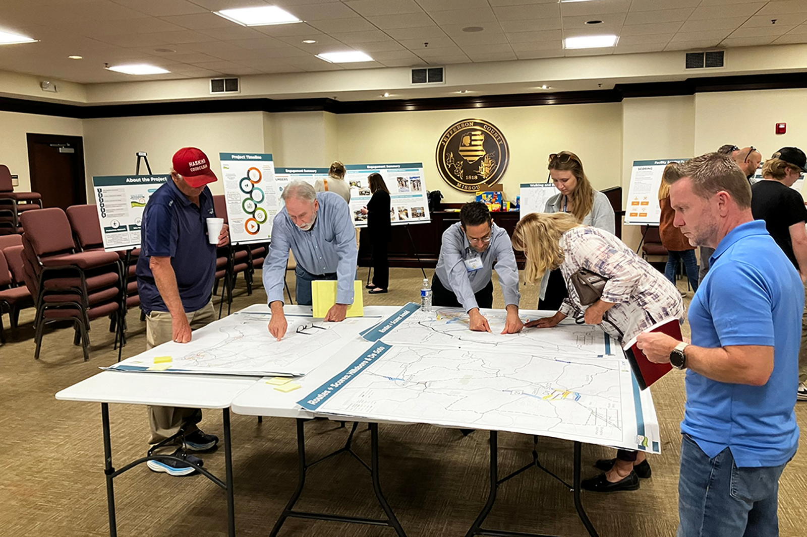
Advancing Mobility Through Bicycle and Pedestrian Masterplan
Advancing Mobility Through Bicycle and Pedestrian Masterplan
Jefferson County (MO) Department of Public Works


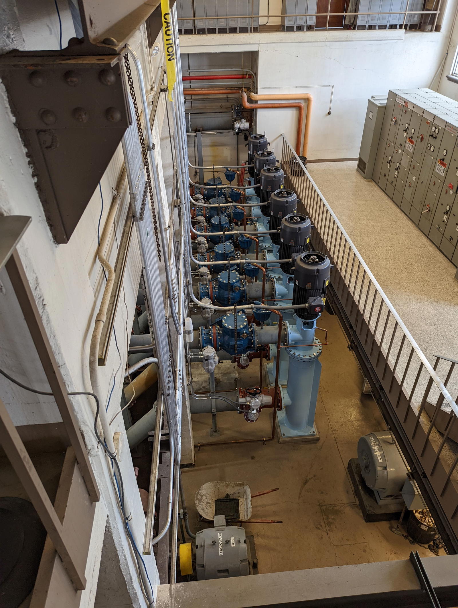
Enabling Joliet’s $1.446 Billion Sustainable Water Supply
Enabling Joliet’s $1.446 Billion Sustainable Water Supply
City of Joliet, IL/Grand Prairie Water Commission


Ongoing Expansion of a World-Class Cargo Hub
Ongoing Expansion of a World-Class Cargo Hub
Chicago-Rockford International Airport, IL

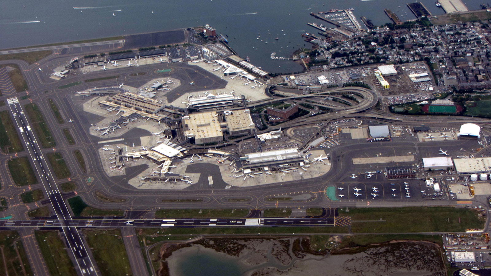
Air Quality and Noise for World’s Busiest Airport
Air Quality and Noise for World’s Busiest Airport
City of Atlanta, Department of Aviation for Hartsfield-Jackson Atlanta International Airport

I-270 Chain of Rocks Canal Bridge Replacement
I-270 Chain of Rocks Canal Bridge Replacement
Illinois Department of Transportation (IDOT)

Scheels Sports Park
Scheels Sports Park
Scheels Sports Park

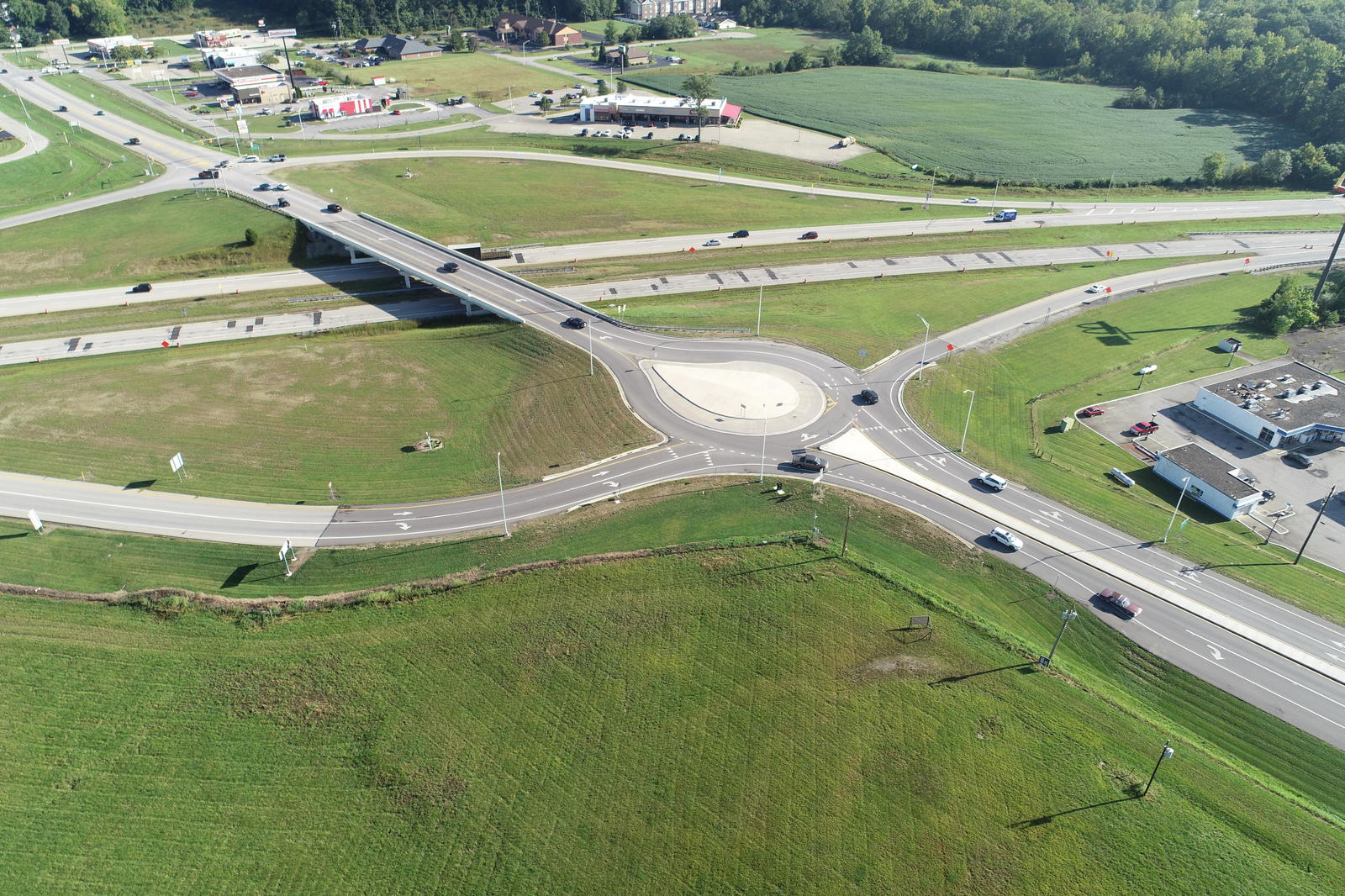
Enhancing Safety at Two High-Crash Intersections
Enhancing Safety at Two High-Crash Intersections
Indiana Department of Transportation (INDOT)


Using CMT Canopy™ to Manage Massive Engineering Data and Workflows for Major Water Supply Project in Chicago Metro
Using CMT Canopy™ to Manage Massive Engineering Data and Workflows for Major Water Supply Project in Chicago Metro
City of Joliet, IL, on behalf of the Grand Prairie Water Commission (Channahon, Crest Hill, Joliet, Minooka, Romeoville & Shorewood)


US 421 Corridor Reconstruction
US 421 Corridor Reconstruction
Indiana Department of Transportation, Seymour District/ City of Madison, IN


Rehabilitating America’s Busiest Runway
Rehabilitating America’s Busiest Runway
Ronald Reagan Washington National Airport (DCA)

A Parallel Path to Safety
A Parallel Path to Safety
Port Bucyrus-Crawford County Airport

Park Over the Highway at St. Louis Gateway Arch
Park Over the Highway at St. Louis Gateway Arch
Missouri Department of Transportation (MoDOT) in Cooperation with the City of St. Louis and the Gateway Arch Park Foundation


Enhancing Safety Along a High-Crash Corridor
Enhancing Safety Along a High-Crash Corridor
Missouri Department of Transportation (MoDOT), SW District


New Snow Removal Equipment Facility (SRE)
New Snow Removal Equipment Facility (SRE)
General Wayne A. Downing Peoria International Airport


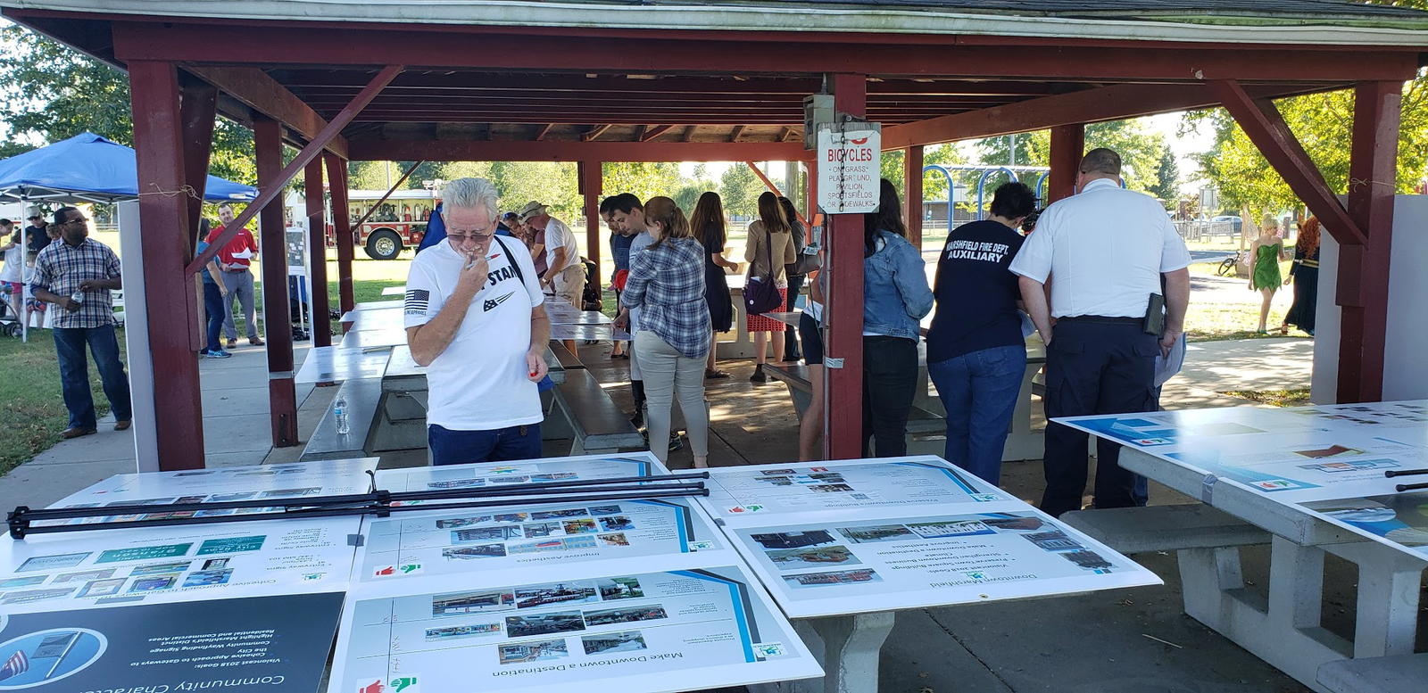


Re-imagining a Great Street
Re-imagining a Great Street
Ferguson, Dellwood and St. Louis Counties, MO

St. Louis Airport Taxiway K Reconstruction
St. Louis Airport Taxiway K Reconstruction
St. Louis Lambert International Airport (STL)


Helping a City Propel Air, Noise, & Energy Initiatives
Helping a City Propel Air, Noise, & Energy Initiatives
City of Philadelphia, PA, Division of Aviation through a contract with Global Program Partners, (GPP) Philadelphia International Airport | Northeast Philadelphia Airport


Comprehensive Environmental Services
Comprehensive Environmental Services
Port Authority of New York and New Jersey (PANYNJ), LaGuardia Airport (LGA)


Practical Design Achievement on New St. Louis Gateway
Practical Design Achievement on New St. Louis Gateway
Missouri Department of Transportation (MoDOT)


Barrington Road Interchange Integrates Pedestrians, Transit & Tollway
Barrington Road Interchange Integrates Pedestrians, Transit & Tollway
The Village of Hoffman Estates, IL; Illinois Tollway; the Illinois Department of Transportation (IDOT) and Pace Suburban Bus


Centering Economic and Environmental Sustainability Through Solids Management Upgrades
Centering Economic and Environmental Sustainability Through Solids Management Upgrades
Kokosing/Plocher LLC for Metropolitan St. Louis Sewer District

Positioning an Aviation Landmark for a Thriving Future
Positioning an Aviation Landmark for a Thriving Future
SUN ‘n FUN Aerospace Center of Excellence (ACE) and Lakeland Linder International Airport (LAL) and Visit Central Florida

Georgia Street Improvements
Georgia Street Improvements
City of Indianapolis, IN in Partnership with Indianapolis Department of Public Works and the 2012 Super Bowl Host Committee


New O’Hare Runway 10R-28L
New O’Hare Runway 10R-28L
City of Chicago Department of Aviation


Taxiway Rehabilitation and Modification of Standards Improvements
Taxiway Rehabilitation and Modification of Standards Improvements
Columbus Regional Airport Authority (CRAA), Rickenbacker International Airport (LCK

Sugar Creek Wastewater Treatment Plant Expansion Delivers Flexible, Sustainable Solutions
Sugar Creek Wastewater Treatment Plant Expansion Delivers Flexible, Sustainable Solutions
Sangamon County Water Reclamation District - Sugar Creek Wastewater Treatment Plant City of Springfield, IL


New Airfield Lighting Vault
New Airfield Lighting Vault
Andrews Air Force Base


O’Hare Modernization Program Environmental Impact Statement (EIS)
O’Hare Modernization Program Environmental Impact Statement (EIS)
Federal Aviation Administration (FAA), Great Lakes Region & O'Hare International Airport (ORD)

Relocation of Montgomery County Fair
Relocation of Montgomery County Fair
Montgomery County Agricultural Society

Centering Funding to Drive Implementation
Centering Funding to Drive Implementation
St. Louis County DOT and Cities of Dellwood and Ferguson, MO

US Hwy 60 & BNSF Corridor Study
US Hwy 60 & BNSF Corridor Study
Missouri Department of Transportation (MoDOT)


Navigating Greenville-Spartanburg International Airport Toward Digital Asset Management
Navigating Greenville-Spartanburg International Airport Toward Digital Asset Management
Greensville-Spartanburg International Airport, SC


Wet Weather Storage Facility, Tank A
Wet Weather Storage Facility, Tank A
Metropolitan St. Louis Sewer District


Bay Drive Park
Bay Drive Park
Flagler County


At-Grade BNSF Rail Crossing Safety Study
At-Grade BNSF Rail Crossing Safety Study
Missouri Department of Transportation (MoDOT), Multi-Modal Department & SW District


The First Double Median U-Turn Intersection (MUT) in Florida
The First Double Median U-Turn Intersection (MUT) in Florida
Florida Department of Transportation (FDOT), District 2

Master Plan for a Unique Airfield
Master Plan for a Unique Airfield
National Science Foundation
Massport Air Quality Support Services
Massport Air Quality Support Services
Massachusetts Port Authority (Massport) – General Edward Lawrence Logan International Airport

Springfield Bicentennial Plaza
Springfield Bicentennial Plaza
Illinois Realtors Association


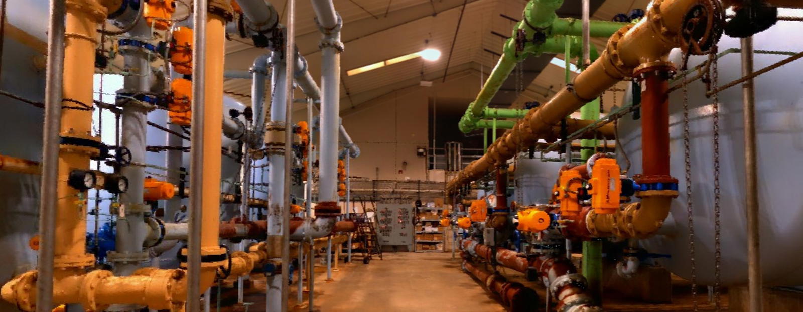
Comprehensive Water Works Improvement
Comprehensive Water Works Improvement
City Water, Light & Power (CWLP)


143rd Street Extension
143rd Street Extension
Village of Plainfield, IL

Upgrading One of Indiana’s Busiest Corridors
Upgrading One of Indiana’s Busiest Corridors
Indiana Department of Transportation (INDOT)

Accommodating Airport Growth Through Master Plan Update
Accommodating Airport Growth Through Master Plan Update
Springfield-Branson National Airport (SGF)

Process Design Improvements at Springfield, IL Wastewater Treatment Plant
Process Design Improvements at Springfield, IL Wastewater Treatment Plant
Sangamon County Water Reclamation District - Spring Creek Wastewater Treatment Facilities


Rapid Runway Reconstruction at Fort Bragg
Rapid Runway Reconstruction at Fort Bragg
U.S. Army Corps of Engineers – Transportation System Center (TSC)
Featured Projects
Bay Drive Park
Bay Drive Park
Flagler County
Rapid Runway Reconstruction at Fort Bragg
Rapid Runway Reconstruction at Fort Bragg
U.S. Army Corps of Engineers – Transportation System Center (TSC)
Upgrading One of Indiana’s Busiest Corridors
Upgrading One of Indiana’s Busiest Corridors
Indiana Department of Transportation (INDOT)
Navigating Greenville-Spartanburg International Airport Toward Digital Asset Management
Navigating Greenville-Spartanburg International Airport Toward Digital Asset Management
Greensville-Spartanburg International Airport, SC
Rehabilitating America’s Busiest Runway
Rehabilitating America’s Busiest Runway
Ronald Reagan Washington National Airport (DCA)
Taxiway Rehabilitation and Modification of Standards Improvements
Taxiway Rehabilitation and Modification of Standards Improvements
Columbus Regional Airport Authority (CRAA), Rickenbacker International Airport (LCK
Ongoing Expansion of a World-Class Cargo Hub
Ongoing Expansion of a World-Class Cargo Hub
Chicago-Rockford International Airport, IL
Air Quality and Noise for World’s Busiest Airport
Air Quality and Noise for World’s Busiest Airport
City of Atlanta, Department of Aviation for Hartsfield-Jackson Atlanta International Airport
Enabling Joliet’s $1.446 Billion Sustainable Water Supply
Enabling Joliet’s $1.446 Billion Sustainable Water Supply
City of Joliet, IL/Grand Prairie Water Commission
At-Grade BNSF Rail Crossing Safety Study
At-Grade BNSF Rail Crossing Safety Study
Missouri Department of Transportation (MoDOT), Multi-Modal Department & SW District
Comprehensive Environmental Services
Comprehensive Environmental Services
Port Authority of New York and New Jersey (PANYNJ), LaGuardia Airport (LGA)
Positioning an Aviation Landmark for a Thriving Future
Positioning an Aviation Landmark for a Thriving Future
SUN ‘n FUN Aerospace Center of Excellence (ACE) and Lakeland Linder International Airport (LAL) and Visit Central Florida
Advancing Mobility Through Bicycle and Pedestrian Masterplan
Advancing Mobility Through Bicycle and Pedestrian Masterplan
Jefferson County (MO) Department of Public Works
St. Louis Airport Taxiway K Reconstruction
St. Louis Airport Taxiway K Reconstruction
St. Louis Lambert International Airport (STL)
O’Hare Modernization Program Environmental Impact Statement (EIS)
O’Hare Modernization Program Environmental Impact Statement (EIS)
Federal Aviation Administration (FAA), Great Lakes Region & O'Hare International Airport (ORD)
New Airfield Lighting Vault
New Airfield Lighting Vault
Andrews Air Force Base
I-270 Chain of Rocks Canal Bridge Replacement
I-270 Chain of Rocks Canal Bridge Replacement
Illinois Department of Transportation (IDOT)
Process Design Improvements at Springfield, IL Wastewater Treatment Plant
Process Design Improvements at Springfield, IL Wastewater Treatment Plant
Sangamon County Water Reclamation District - Spring Creek Wastewater Treatment Facilities
US 421 Corridor Reconstruction
US 421 Corridor Reconstruction
Indiana Department of Transportation, Seymour District/ City of Madison, IN
Re-imagining a Great Street
Re-imagining a Great Street
Ferguson, Dellwood and St. Louis Counties, MO
The First Double Median U-Turn Intersection (MUT) in Florida
The First Double Median U-Turn Intersection (MUT) in Florida
Florida Department of Transportation (FDOT), District 2
Relocation of Montgomery County Fair
Relocation of Montgomery County Fair
Montgomery County Agricultural Society
Centering Funding to Drive Implementation
Centering Funding to Drive Implementation
St. Louis County DOT and Cities of Dellwood and Ferguson, MO
US Hwy 60 & BNSF Corridor Study
US Hwy 60 & BNSF Corridor Study
Missouri Department of Transportation (MoDOT)
Using CMT Canopy™ to Manage Massive Engineering Data and Workflows for Major Water Supply Project in Chicago Metro
Using CMT Canopy™ to Manage Massive Engineering Data and Workflows for Major Water Supply Project in Chicago Metro
City of Joliet, IL, on behalf of the Grand Prairie Water Commission (Channahon, Crest Hill, Joliet, Minooka, Romeoville & Shorewood)
Accommodating Airport Growth Through Master Plan Update
Accommodating Airport Growth Through Master Plan Update
Springfield-Branson National Airport (SGF)
Wet Weather Storage Facility, Tank A
Wet Weather Storage Facility, Tank A
Metropolitan St. Louis Sewer District
Scheels Sports Park
Scheels Sports Park
Scheels Sports Park
Barrington Road Interchange Integrates Pedestrians, Transit & Tollway
Barrington Road Interchange Integrates Pedestrians, Transit & Tollway
The Village of Hoffman Estates, IL; Illinois Tollway; the Illinois Department of Transportation (IDOT) and Pace Suburban Bus
Park Over the Highway at St. Louis Gateway Arch
Park Over the Highway at St. Louis Gateway Arch
Missouri Department of Transportation (MoDOT) in Cooperation with the City of St. Louis and the Gateway Arch Park Foundation
Comprehensive Water Works Improvement
Comprehensive Water Works Improvement
City Water, Light & Power (CWLP)
Practical Design Achievement on New St. Louis Gateway
Practical Design Achievement on New St. Louis Gateway
Missouri Department of Transportation (MoDOT)
Massport Air Quality Support Services
Massport Air Quality Support Services
Massachusetts Port Authority (Massport) – General Edward Lawrence Logan International Airport
Centering Economic and Environmental Sustainability Through Solids Management Upgrades
Centering Economic and Environmental Sustainability Through Solids Management Upgrades
Kokosing/Plocher LLC for Metropolitan St. Louis Sewer District
Springfield Bicentennial Plaza
Springfield Bicentennial Plaza
Illinois Realtors Association
Enhancing Safety at Two High-Crash Intersections
Enhancing Safety at Two High-Crash Intersections
Indiana Department of Transportation (INDOT)
New Snow Removal Equipment Facility (SRE)
New Snow Removal Equipment Facility (SRE)
General Wayne A. Downing Peoria International Airport
Helping a City Propel Air, Noise, & Energy Initiatives
Helping a City Propel Air, Noise, & Energy Initiatives
City of Philadelphia, PA, Division of Aviation through a contract with Global Program Partners, (GPP) Philadelphia International Airport | Northeast Philadelphia Airport
Enhancing Safety Along a High-Crash Corridor
Enhancing Safety Along a High-Crash Corridor
Missouri Department of Transportation (MoDOT), SW District
143rd Street Extension
143rd Street Extension
Village of Plainfield, IL
Master Plan for a Unique Airfield
Master Plan for a Unique Airfield
National Science Foundation
A Parallel Path to Safety
A Parallel Path to Safety
Port Bucyrus-Crawford County Airport
Georgia Street Improvements
Georgia Street Improvements
City of Indianapolis, IN in Partnership with Indianapolis Department of Public Works and the 2012 Super Bowl Host Committee
Sugar Creek Wastewater Treatment Plant Expansion Delivers Flexible, Sustainable Solutions
Sugar Creek Wastewater Treatment Plant Expansion Delivers Flexible, Sustainable Solutions
Sangamon County Water Reclamation District - Sugar Creek Wastewater Treatment Plant City of Springfield, IL
New O’Hare Runway 10R-28L
New O’Hare Runway 10R-28L
City of Chicago Department of Aviation